Large selection of products and fast shipping!
  • Shopping cart

    Your cart is currently empty

    Product Detail

    EastWest Mapping Lugnaquilla & Glendalough 1:25000 Encapsulated Map adventure.ie
    EastWest Mapping Lugnaquilla & Glendalough 1:25000 Encapsulated Map adventure.ie
    EastWest Mapping Lugnaquilla & Glendalough 1:25000 Encapsulated Map adventure.ie
    EastWest Mapping Lugnaquilla & Glendalough 1:25000 Encapsulated Map adventure.ie

    Lugnaquilla & Glendalough 1:25000 Encapsulated Map adventure.ie

    €23,95
    Incl. tax
    In stock

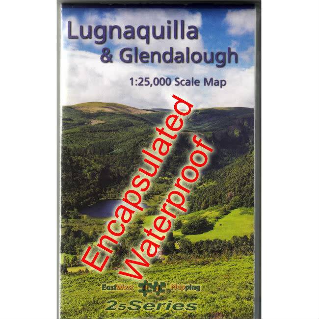
    EastWest Lugnaquilla & Glendalough 1:25000. An invaluable map for any hiker visiting the Glendalough area. EastWest Maps are renowned for their detailed mapping, track information & historical data.

    An online mountain store for adventurous people.

    Experts in the outdoors since 1999

    We all work and play in the outdoors on events, expeditions, rescues or purely for fun! We understand your needs.

    Ask us anything!

    Use our chat feature to ask us questions just as you would if you were in store!

    Free ROI Delivery When You Spend €70 Or More

    Free EU Delivery over €200. Free delivery level may increase during sales, t&cs apply.

    Hassle Free Returns

    Returns are a pain. We'll do our best to make the process as easy and straightforward as possible. See our policy below.

    Lugnaquilla & Glendalough 1:25000 Encapsulated Map

    Updated from the 1:30,000 version and released in April 2018, EastWest Mapping's Lugnaquilla & Glendalough 1:25000 Encapsulated Map is another exceptional piece of mapping now in a scale made easier for calculating legs.

    5 metre contour lines show amazing detail among the peat hags, and as is the norm with EastWest Mapping, the level of track information and historical place name data is outstanding.

    Lugnaquilla & Glendalough 1:25000 Encapsulated Map

    This fully encapsulated map is protected from the elements and a sound investment for any hiker in this area and a must-have for MS and ML students.

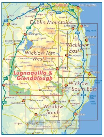
    Wicklow mountain peaks covered:

    • Church Mountain
    • Lowbawn
    • Tonelagee
    • Brockagh
    • Mullacor
    • Keadeen
    • Lugnaquilla
    • Croghanmaoire
    • Arts Cross

    Also providing mapping of the Wicklow Gap, Glenmalure, Glendalough valleys.


    1:25000 / 1:25000 map / eastwest / eastwest maps / encapsulated map / Glendalough Map / ireland / laminated maps / lug map / Lugnaquilla Map / Map / osi / sheet 56 / waterproof map / wicklow mountains

    Similar Products

    Subscribe to our newsletter

    Receive the latest updates on new arrivals, events and promotions.

    Please accept cookies to help us improve this website Is this OK? Yes No More on cookies »