Large selection of products and fast shipping!
Your cart is currently empty
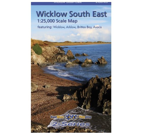


Wicklow South East 1:25000 Paper Map. Definitive detailed map from EastWest Mapping’s 25Series of South East Wicklow at 1:25,000 scale covering the coast from Wicklow town to Arklow and inland to Rathdrum & Avoca. Brittas Bay, Carrick Mountain and Avoca
We all work and play in the outdoors on events, expeditions, rescues or purely for fun! We understand your needs.
Use our chat feature to ask us questions just as you would if you were in store!
Free EU Delivery over €200. Free delivery level may increase during sales, t&cs apply.
Returns are a pain. We'll do our best to make the process as easy and straightforward as possible. See our policy below.
Depicts this densely settled region in very considerable detail for the benefit of both visitor and local alike. EastWest have conducted considerable research into local sites & placenames and much information is recorded on a map here for the first time. Printed on good quality Progeo 90gsm map paper. The map sheet measures 1125mm x 820mm, covering 550 sq kilometres and is folded down to 125mm x 205mm. Read care instructions in FAQ.
Available both in standard folded paper version and folded encapsulated for durability and weatherproofing.
1:25,000 Scale : 1 centimetre on the map = 250 metres on the ground. Contour Interval: 5 metres.
Published January 2018.
EastWest Mapping has been providing small scale survey & cartographic services since 1990. Their cartographic work falls into two broad categories: firstly maps to illustrate recreational activities such as hill walking, cycling, waterways, location maps etc. and secondly Eastwest Mapping have published a number of sheets of regional mapping at scales from 1:25,000 to 1:30,000. A dedication in local history, heritage, nature, photography & music is very apparent from their work.
Product carousel items


