Large selection of products and fast shipping!
Your cart is currently empty
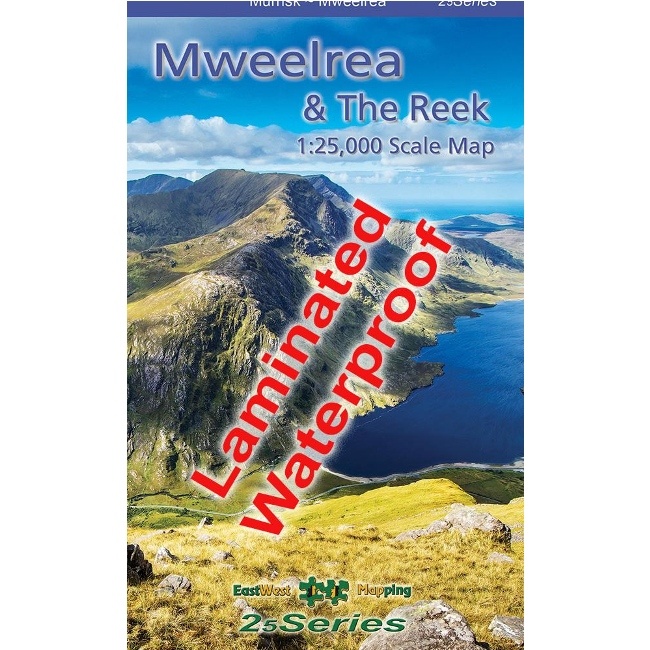


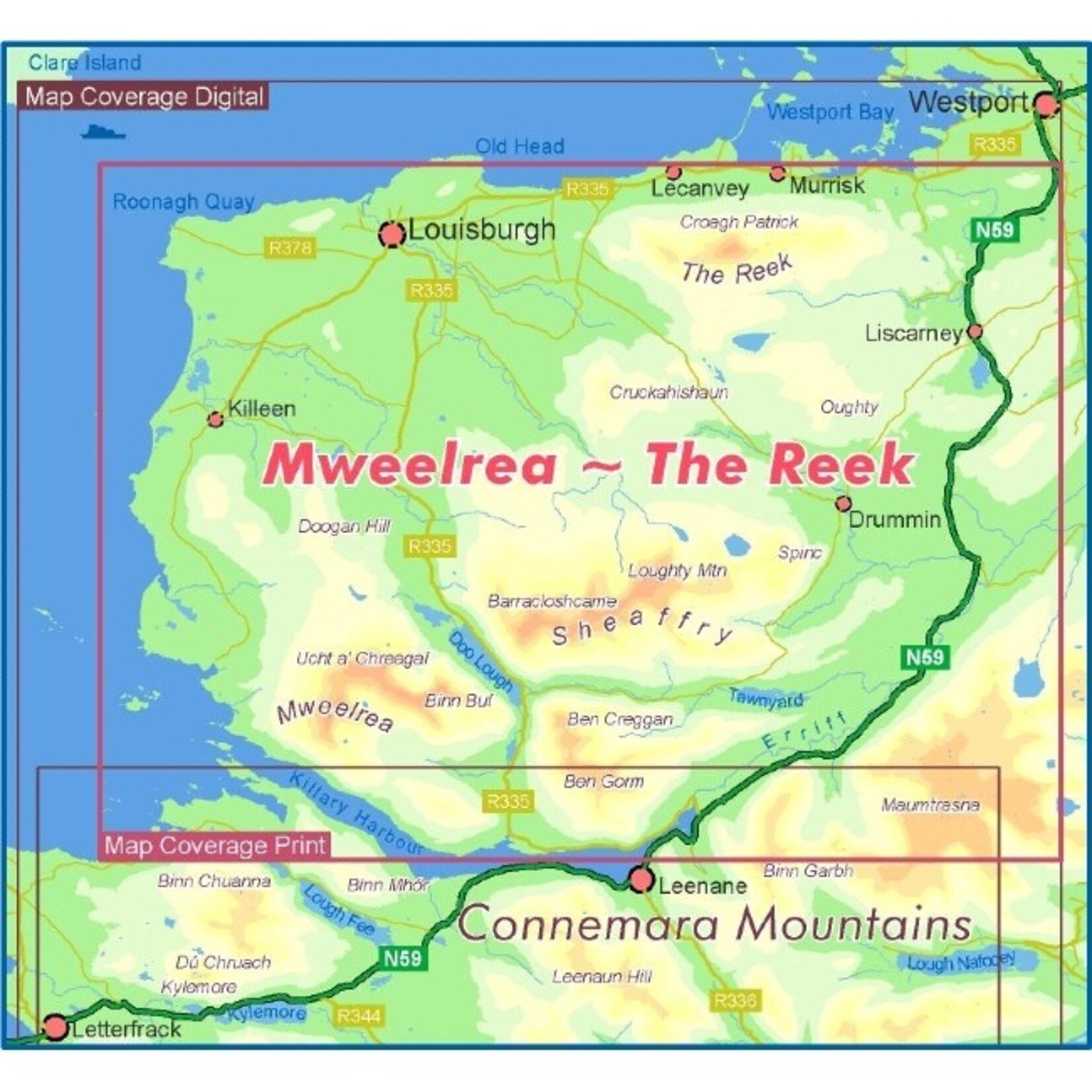
Another fantastic detailed map from EastWest Mapping. At 1:25,000 scale, it covers Mweelrea and the region from Killary Harbour to Clew Bay including the Sheaffrey Hills and The Reek (Croagh Patrick).
We all work and play in the outdoors on events, expeditions, rescues or purely for fun! We understand your needs.
Use our chat feature to ask us questions just as you would if you were in store!
Free EU Delivery over €200. Free delivery level may increase during sales, t&cs apply.
Returns are a pain. We'll do our best to make the process as easy and straightforward as possible. See our policy below.
Another fantastic detailed map from EastWest Mapping. At 1:25,000 scale, it covers Mweelrea and the region from Killary Harbour to Clew Bay including the Sheaffrey Hills and The Reek (Croagh Patrick).
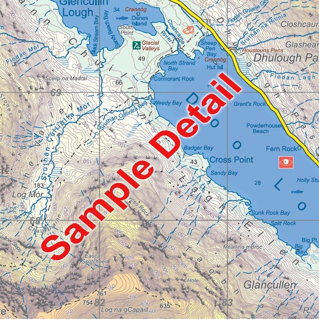
Produced to their 25Series standard, this general topographic map has a 5 metre contour interval for fine navigation. Signposted walking trails are depicted.
This is the waterproof (laminated/encapsulated) version of the most detailed map of this popular region. The map sheet measures 1125mm x 820mm, covering 550 sq kilometres and is folded down to 125mm x 205mm.
Surveyed & published 2023-2024.
Product carousel items


